Skip to content

Hike for Homeless

Events

The most unique and anticipated walking event on the UK charity calendar.

  • Start Date: 20th Jun, 2026 @ 8:00am
  • Closing Date: 20th Jun, 2026 @ 8:00pm
  • Location: Kinver Edge & Wyre Forest

Go Back to Events

Hike for Homeless

The most unique and anticipated walking event on the UK charity calendar.

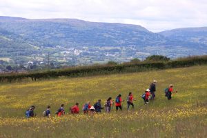
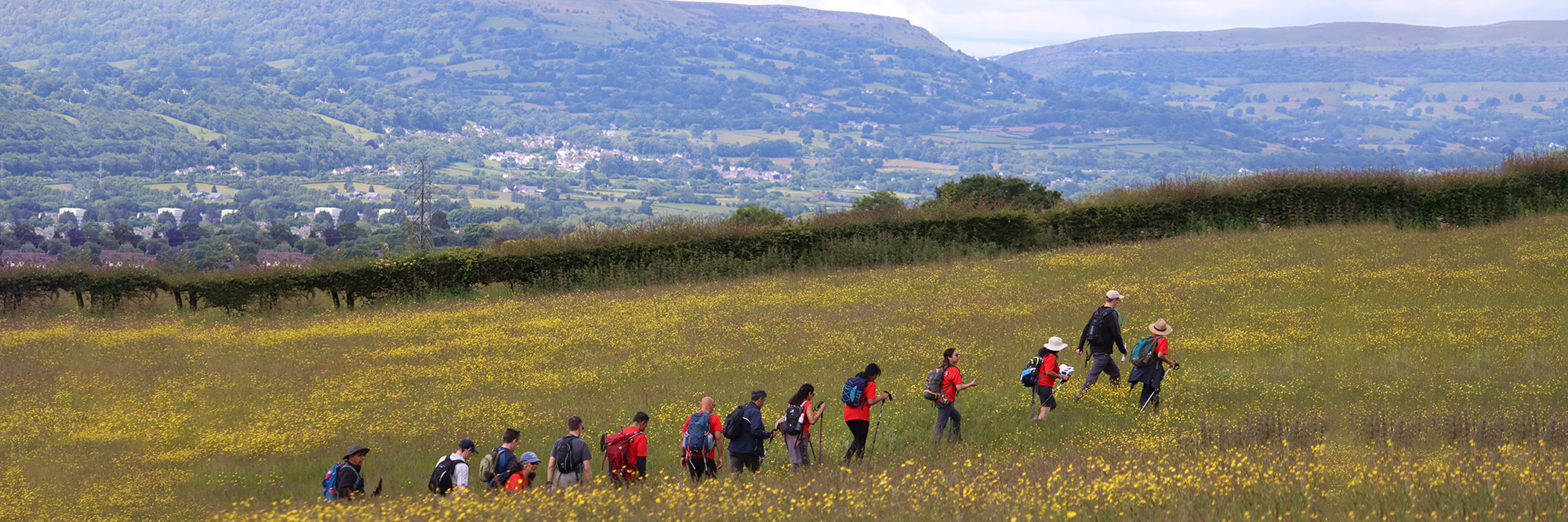
Mark your calendars for Saturday 20th June 2026! Our 2026 hike will be held at the Kinver Edge & Wyre Forest area- with stunning views and interesting features.

Give yourself a New Year’s Challenge that gives back.


Register your interest in Hike for Homeless 2026

We will email you in 2026 to remind you of the date.
The information you provide in this from will only be used for processing your request – please see our Privacy Notice for more information on how we use and process your data.

Name

Signing up here will qualify you for entrance to our EARLY BIRD FEE!


Kinver Edge and Wyre Forest offer a unique blend of natural beauty and historical significance.

The Kinver Edge is a high heath and woodland forest with a rich history, including the last troglodyte dwellings in England – rock caves with intricate carvings!

The Wyre Forest is one of the largest oak woodlands in England, offering miles of way-marked paths and trails suitable for all abilities.

The hike starts and finishes from the beautiful Bodenham Arboretum, and we will be having a party at the finish line!

Please note, teams must be between 3 to 6 people. You can sign up multiple teams. Check out our FAQ’s for more information.

Please read the Terms & Conditions for this event here.

3 Walk Lengths  

Short

Starts 10am. Approximately 7.5 miles, taking in views of beautiful Kinver Edge, with rock houses and breath-taking views.

Medium

Starts 9am. Approximately 17 miles including Kinver Edge, pleasant woodland walk Arley Wood and quaint TV favourite, Arley train station.

Long

Starts 8am. Approximately 24.5 miles with all of the above plus the stunning trees of Wyre Forest and eighteenth-century water-powered grain mill Knowles Mill.

Why Take Part?

  • This genuine old school navigating challenge is a great way to bond with members of your hike team.
  • It’s a great opportunity for companies to team build and achieve their CSR goals,  whilst creating a healthy fun rivalry with firms from their industry sector. 
  • It’s a family friendly event with our stops being a great chance to regroup with kids.
  • It’s a chance to set and reach personal fitness goals. Sign up in the new year and train by taking longer walks or mini-hikes! 
  • You can do this all whilst doing something good for charity – helping local homeless young people find not just a roof – but a home and better future with opportunities to grow. 

What You Need To Know

Throughout all walk lengths, there will be checkpoints available with staff, water, toilets and energy treats on route. 

All teams get a map, an illustrated guide and a GPX file of their chosen route.  

At the end, in the beautiful setting of Bodenham Arboretum, you can buy hot food and drinks, celebrating your hard work as a team. 

We are a dog friendly event. Just make sure you have planned to make it comfortable for them, too!

We create a fundraising page for you automatically, making fundraising as easy as ever. All you have to do is share, and we will send you tips and tricks to maximise your fundraising.

Professionally designed H4H walking t-shirts are available for purchase. Check back to this page to see our new design, coming soon! 


Last Year's Hike

FAQs

Where does Hike for Homeless usually take place?
  • The event is held in a different part of the UK every summer. We choose iconic walking locations to maximise the visual experience. As a rule of thumb, the locations are chosen because they fall within a 2 ½ hour drive from our head quarters in Birmingham city centre. We’ve been to Brecon beacons, the Cotswolds and the Peak District to name a few.
How steep is this year’s hike/ what are the elevations?
  • The elevations of the Hikes differ per length. As an example – here are the elevation graphs for each of the individual routes, from Long to Short for 2025:
Can I do the Hike on my own?
  • Unfortunately, we cannot have lone hikers take part. The minimum amount of people in a team must be 3 for health & safety reasons.
How many people can I have in a team?
  • The minimum is 3 people and the maximum is 6 people per team. If your group is larger than 6 people, simply create more teams. For example, if 8 of you wanted to sign up, you could create 2 teams of 4 people. This way we can more easily keep track of teams and increase the friendly competition!
I’m not sure which length of Hike suits me. How long will it take?
  • The short route is designed for young families and people who don’t regularly hike, and should take around 2/3 hours.
    The medium route most people who exercise regularly can do, and should take around 5/6 hours.
    The Long route can be tough, and you’ll need to be relatively fit to achieve this- it should take around 10/11 hours.
Are there check points?
  • Yes. These are spaced according to the terrain and accessibility. All check points are staffed by our friendly marshals who will check you through to make sure you’re all ok. You can also get energy treats and water at these points. We will aim to provide portaloos where we can at these check points as well, pending permission.
Can I bring my dog?
  • Furry friends are very welcome- you must bring a lead with you, and always leash your pet when crossing farm land or instructed to do so by the land owner. Please also be aware to bring all of the necessities- water, treats, and waste bags.
What if I injure myself or feel I can’t carry on?
  • If you are injured to the point you can’t move, ask one of your teammates to phone 999 and stay with you whilst another member goes to the nearest check point to inform a marshal.
    If you can, make your way to the nearest check point- we will give you a lift to the finish line so you can retire.
What should I bring with me?
  • Ensure you bring your team map and guide booklet- we will send this to you after you have registered your team. Bring with you a mobile phone and portable charger, wearing clothing suitable for all weathers and for walking. We advise you wear good, worn-in walking boots. Make sure you have a rucksack, snacks and a water bottle to be refilled at the check points.
Are there signs on the route? Will I be on private land?
  • This event is legendary for its orienting element- there will be no signs. If you follow the guide and use the map, you should follow the designated route quite easily. Every inch of all routes is on public footpaths or public highways.
How much do I need to raise?
  • As much as you can! Each £16 raised helps us pay for a night’s accommodation for a disadvantaged young person. You could aim for 10 nights, a month- some people have even fundraised to cover a whole year! Once your fundraising page is automatically set up, we will give you tips, tricks, and we’ll even have someone on hand to be on your side and answer any queries, every step of the way.
What does the money raised go to?
  • St Basils works with young people to enable them to find and keep a home, grow their confidence, develop their skills, increase opportunities and prevent homelessness. We rely on the support of fundraisers like yourself to prevent youth homelessness for young people aged 16-25. We help 4,000 young people every single year, and are short of £16 per young person per night to provide accommodation. Browse our website for more about St Basils.